


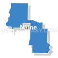
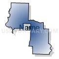
Faulkner & Lonoke Counties PUMA, Arkansas
About
Outline

Summary
| Unique Area Identifier | 192180 |
| Name | Faulkner & Lonoke Counties PUMA |
| State | Arkansas |
| Area (square miles) | 1,466.91 |
| Land Area (square miles) | 1,418.61 |
| Water Area (square miles) | 48.30 |
| % of Land Area | 96.71 |
| % of Water Area | 3.29 |
| Latitude of the Internal Point | 34.70006580 |
| Longtitude of the Internal Point | -91.87761960 |
Maps


Graphs
Select a template below for downloading or customizing gragh for Faulkner & Lonoke Counties PUMA, Arkansas


Neighbors
Neighoring Public Use Microdata Area (by Name) Neighboring Public Use Microdata Area on the Map
- Independence, Cleburne, Van Buren, Sharp, Izard, Stone & Fulton Counties PUMA, AR
- Jefferson, Grant & Arkansas (Northwest) Counties PUMA, AR
- Pope, Johnson, Yell, Conway & Perry Counties PUMA, AR
- Pulaski County (Outer)--North Little Rock, Sherwood & Jacksonville Cities PUMA, AR
- White, Jackson, Prairie & Woodruff Counties PUMA, AR
Top 10 Neighboring County (by Population) Neighboring County on the Map
- Pulaski County, AR (382,748)
- Faulkner County, AR (113,237)
- Jefferson County, AR (77,435)
- White County, AR (77,076)
- Lonoke County, AR (68,356)
- Cleburne County, AR (25,970)
- Conway County, AR (21,273)
- Arkansas County, AR (19,019)
- Van Buren County, AR (17,295)
- Perry County, AR (10,445)
Top 10 Neighboring County Subdivision (by Population) Neighboring County Subdivision on the Map
- Big Rock township, Pulaski County, AR (219,984)
- Hill township, Pulaski County, AR (162,764)
- Cadron township, Faulkner County, AR (68,003)
- York township, Lonoke County, AR (22,085)
- Union township, White County, AR (9,421)
- Hardin township, Faulkner County, AR (6,775)
- Cypress township, Faulkner County, AR (5,480)
- Caroline township, Lonoke County, AR (5,238)
- Lonoke township, Lonoke County, AR (5,191)
- Magness township, Lonoke County, AR (5,084)
Top 10 Neighboring Place (by Population) Neighboring Place on the Map
- Conway city, AR (58,908)
- Jacksonville city, AR (28,364)
- Cabot city, AR (23,776)
- Maumelle city, AR (17,163)
- Greenbrier city, AR (4,706)
- Lonoke city, AR (4,245)
- Ward city, AR (4,067)
- Vilonia city, AR (3,815)
- England city, AR (2,825)
- Mayflower city, AR (2,234)
Top 10 Neighboring Unified School District (by Population) Neighboring Unified School District on the Map
- Pulaski County Special School District, AR (152,855)
- Conway Public Schools, AR (70,098)
- Cabot Public Schools, AR (48,187)
- Beebe School District, AR (17,431)
- South Conway County School District, AR (15,782)
- Greenbrier School District, AR (15,028)
- Vilonia School District, AR (14,891)
- Lonoke School District, AR (9,959)
- DeWitt School District, AR (8,785)
- Mayflower School District, AR (6,142)
Top 10 Neighboring State Legislative District Lower Chamber (by Population) Neighboring State Legislative District Lower Chamber on the Map
- State House District 48, AR (41,391)
- State House District 46, AR (35,918)
- State House District 47, AR (34,367)
- State House District 45, AR (32,959)
- State House District 42, AR (32,375)
- State House District 49, AR (32,244)
- State House District 59, AR (29,163)
- State House District 15, AR (29,068)
- State House District 60, AR (28,463)
- State House District 18, AR (27,129)
Top 10 Neighboring State Legislative District Upper Chamber (by Population) Neighboring State Legislative District Upper Chamber on the Map
- State Senate District 22, AR (109,730)
- State Senate District 30, AR (103,943)
- State Senate District 28, AR (91,744)
- State Senate District 31, AR (91,111)
- State Senate District 18, AR (85,656)
- State Senate District 29, AR (85,160)
- State Senate District 12, AR (83,956)
- State Senate District 23, AR (75,803)
- State Senate District 32, AR (75,578)
- State Senate District 34, AR (71,300)
Top 10 Neighboring 111th Congressional District (by Population) Neighboring 111th Congressional District on the Map
- Congressional District 2, AR (751,377)
- Congressional District 1, AR (687,694)
- Congressional District 4, AR (654,283)
Top 10 Neighboring Census Tract (by Population) Neighboring Census Tract on the Map
- Census Tract 305.01, Faulkner County, AR (10,850)
- Census Tract 712, White County, AR (9,546)
- Census Tract 43.05, Pulaski County, AR (7,402)
- Census Tract 201.04, Lonoke County, AR (7,068)
- Census Tract 710, White County, AR (7,016)
- Census Tract 201.01, Lonoke County, AR (6,749)
- Census Tract 310.05, Faulkner County, AR (6,603)
- Census Tract 302, Faulkner County, AR (6,052)
- Census Tract 34.02, Pulaski County, AR (5,930)
- Census Tract 303.02, Faulkner County, AR (5,622)
Top 10 Neighboring 5-Digit ZIP Code Tabulation Area (by Population) Neighboring 5-Digit ZIP Code Tabulation Area on the Map
- 72034, AR (44,723)
- 72076, AR (37,979)
- 72023, AR (35,026)
- 72120, AR (31,610)
- 72032, AR (31,436)
- 72118, AR (22,592)
- 72113, AR (21,273)
- 72223, AR (19,890)
- 72058, AR (15,911)
- 72117, AR (12,684)